


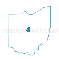
CONGRESS TWP WEST, Morrow County, Ohio
About
Outline

Summary
| Unique Area Identifier | 650719 |
| Name | CONGRESS TWP WEST |
| County | Morrow County |
| State | Ohio |
| Area (square miles) | 8.85 |
| Land Area (square miles) | 8.54 |
| Water Area (square miles) | 0.31 |
| % of Land Area | 96.50 |
| % of Water Area | 3.50 |
| Latitude of the Internal Point | 40.60770510 |
| Longtitude of the Internal Point | -82.78271180 |
Maps


Graphs
Select a template below for downloading or customizing gragh for CONGRESS TWP WEST, Morrow County, Ohio


Neighbors
Neighoring Voting District (by Name) Neighboring Voting District on the Map
- CONGRESS TWP EAST, Morrow County, OH
- FRANKLIN TWP, Morrow County, OH
- GILEAD TWP NE, Morrow County, OH
- N BLOOMFIELD TWP E, Morrow County, OH
- N BLOOMFIELD TWP W, Morrow County, OH
- WASHINGTON TWP, Morrow County, OH
Top 10 Neighboring County Subdivision (by Population) Neighboring County Subdivision on the Map
- Gilead township, Morrow County, OH (6,112)
- Congress township, Morrow County, OH (2,701)
- North Bloomfield township, Morrow County, OH (1,863)
- Franklin township, Morrow County, OH (1,617)
- Washington township, Morrow County, OH (1,300)
Top 10 Neighboring Place (by Population) Neighboring Place on the Map
Top 10 Neighboring Unified School District (by Population) Neighboring Unified School District on the Map
- Mount Gilead Exempted Village School District, OH (8,081)
- Northmor Local School District, OH (7,778)
Top 10 Neighboring State Legislative District Lower Chamber (by Population) Neighboring State Legislative District Lower Chamber on the Map
Top 10 Neighboring State Legislative District Upper Chamber (by Population) Neighboring State Legislative District Upper Chamber on the Map
Top 10 Neighboring 111th Congressional District (by Population) Neighboring 111th Congressional District on the Map
Top 10 Neighboring Census Tract (by Population) Neighboring Census Tract on the Map
- Census Tract 9652, Morrow County, OH (7,089)
- Census Tract 9654, Morrow County, OH (6,115)
- Census Tract 9651, Morrow County, OH (4,643)
- Census Tract 9650, Morrow County, OH (4,292)